
Hazel Dell ZIP Coverage
The strongest verified postal match for Hazel Dell is 98665. Three other codes appear in the broader Hazel Dell, Highway 99, Felida, and Salmon Creek area, but none should be treated as automatic proof that an address lies inside the census-designated place. Clark County parcel examples and civic records support the distinctions below. USPS should confirm the exact deliverable address and current postal assignment.
| Postal code | Documented local use | Post office | Boundary note |
|---|---|---|---|
| 98665 | Primary Hazel Dell parcel, park, and Northeast association examples | Verify current station with USPS | Strongest documented Hazel Dell match |
| 98663 | West and older Hazel Dell fringe; CCGS on NE 52nd Street | Verify current station with USPS | Postal area can cross city and neighborhood labels |
| 98685 | Northwest area and a parcel on NE Hazel Dell Avenue | Verify current station with USPS | Sample parcel is labeled Felida Community by PIC |
| 98686 | Adjacent Salmon Creek and northern Highway 99 area | Verify current station with USPS | Adjacent service area, not wholly Hazel Dell |
No official table was found that intersects the 2020 Hazel Dell CDP polygon with every USPS ZIP polygon. The careful statement is therefore narrow: 98665 has the strongest local evidence, while 98663, 98685, and 98686 are broader-area codes that need address-level confirmation.
Why Hazel Dell Uses 98665
Several county sources tie 98665 directly to Hazel Dell. PIC sample cards place addresses on NE 95th Circle and NE Minnehaha Street in that postal code, and the parcel data labels their local neighborhood context. Hazel Dell Community Park and Northeast Hazel Dell material also use 98665 addresses. Those records make it the safest first code in a ZIP code directory search.
Even here, the ZIP does not define the CDP. A postal code exists for mail delivery, while the Census Bureau draws a statistical boundary. Clark County maintains separate parcel, neighborhood, city, school, fire, utility, election, and planning layers. One 98665 address can therefore belong to several districts at once without those districts sharing the ZIP outline.
Nearby Hazel Dell ZIP Areas
Use 98663, 98685, and 98686 as leads, not conclusions. The Clark County Genealogical Society at NE 52nd Street provides a documented 98663 example in the west and older Hazel Dell fringe. A PIC card for 10000 NE Hazel Dell Avenue uses 98685 yet labels the parcel's neighborhood as Felida Community. County licensing material places a Highway 99 address farther north in 98686.
This is the local geography trap: a road name containing “Hazel Dell” can continue beyond the core CDP, and a postal city of Vancouver can appear on an unincorporated address. Search results should be attached to the parcel, not to a broad claim about everyone in the ZIP. The account number and map location are better jurisdiction checks than the mailing label alone.
Boundary tip. Treat an area ZIP as a search lead, then use the parcel map to confirm Hazel Dell geography.
Map Hazel Dell ZIP Layers
Clark County's GIS map index is the best public way to compare postal geography with local boundaries. Its administrative layers include ZIPs, neighborhoods, Census geography, cities, schools, utilities, public safety, elections, and taxing districts. Locate the parcel first, then turn on one layer at a time. That keeps a ZIP boundary from being confused with a neighborhood association line or Vancouver's city boundary.
The Clark County map index lists the ZIP and administrative layers used for a parcel-level comparison.
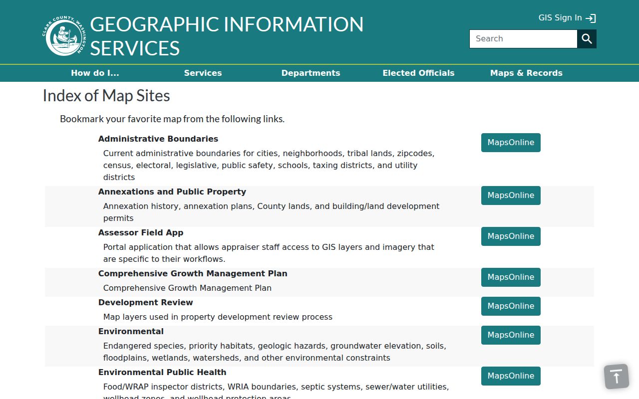
The map layer is a boundary aid, not a list of residents. After identifying the correct parcel and ZIP, move to the record system that answers the actual question.
Find Hazel Dell Residents by ZIP
There is no verified local portal that returns every Hazel Dell resident from a ZIP alone. PIC documents address and tax-account searches, not a public ZIP-wide resident filter. MapsOnline displays a ZIP layer but no confirmed one-click export of people. VoteWA has no ZIP field because it is a self-directed registration check.
- Confirm the full address with the USPS ZIP Code Lookup. Use the city-and-state or address route, and keep the result with the research notes.
- Locate the address in Clark County PIC by street or tax account. Record situs, mailing ZIP, legal description, owner, and account as separate fields.
- Open MapsOnline or the county map index. Compare the ZIP layer with the parcel, CDP, city boundary, and neighborhood layers.
- For lawful voter research, request a countywide or statewide database extract from the Secretary of State and follow the statutory limits. The file uses address, precinct, and district data, not a casual public ZIP browser.
- Once the code narrows to a road, use the Hazel Dell street directory workflow to examine address-keyed property, deed, permit, and historical sources.
A ZIP code directory is most useful as a filter between a broad place name and an exact parcel. It cannot replace address validation or prove that a named person currently occupies the address.
Verify a Hazel Dell ZIP
The USPS lookup is the source for the current postal form, but its interactive Hazel Dell result and precise station assignment were not preserved in the research capture. That gap matters. Do not invent a station name or claim that a broad city-and-state result proves an address belongs inside Hazel Dell.
| Lookup route | What to enter | What it can confirm | What it cannot confirm |
|---|---|---|---|
| Address lookup | Street, city, and state | Standard postal form and ZIP result | CDP or municipal jurisdiction |
| City and state | Vancouver or another valid postal city, Washington | ZIPs associated with that postal city | That every result serves Hazel Dell |
| ZIP lookup | Known five-digit code | Postal city information | Parcel, owner, or resident identity |
The USPS city-and-state lookup screen provides the official interactive starting point.
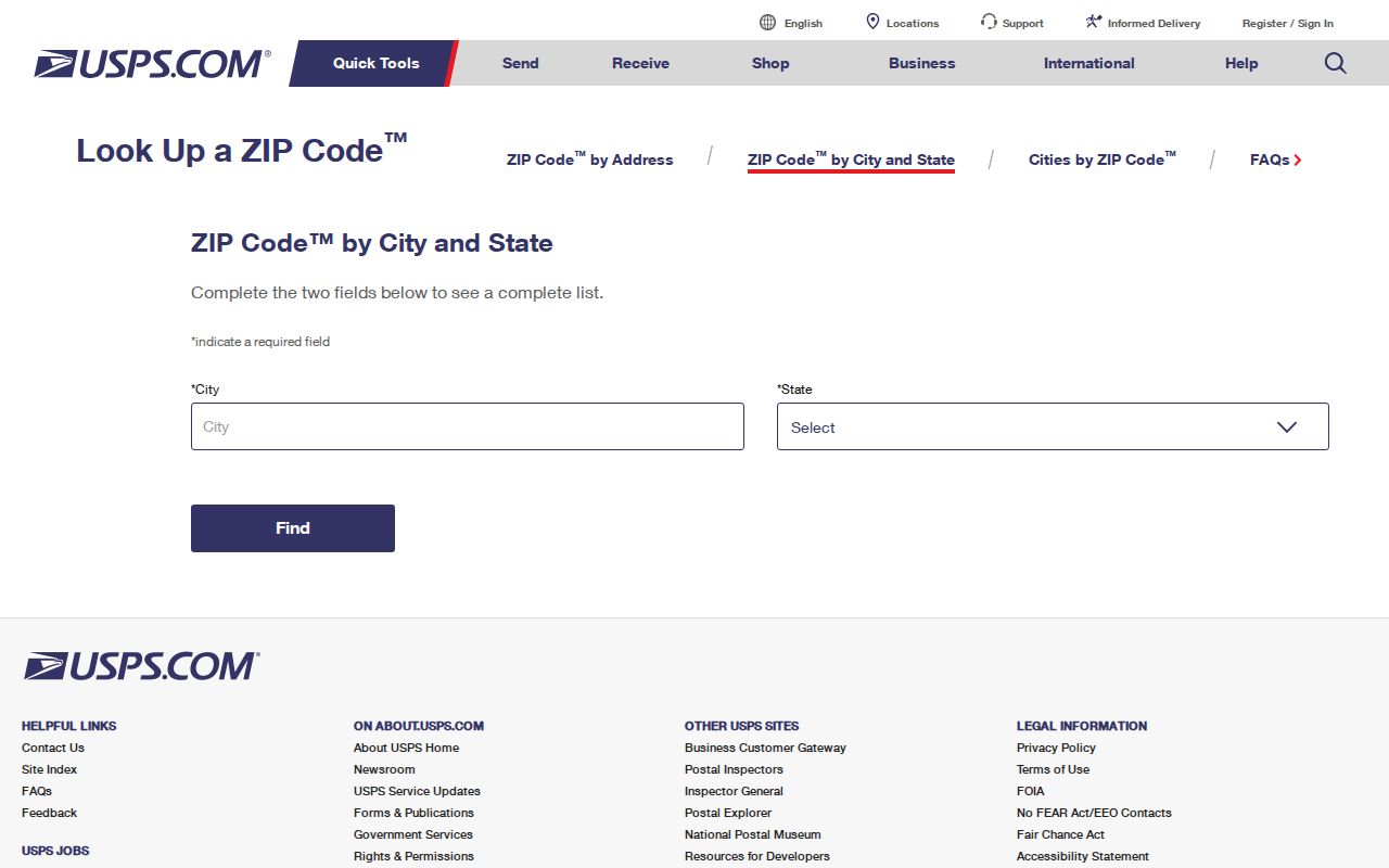
Pair the postal answer with county GIS. USPS describes delivery geography, while Clark County identifies the parcel and governing jurisdictions.
Separate Hazel Dell Address Fields
A property card may show a situs ZIP and a different mailing ZIP. The situs field points to the parcel's physical location. The mailing field is where tax correspondence goes and may belong to an owner, agent, trust, or company outside the area. A legal description defines land without relying on a postal code at all.
This distinction explains why searching a ZIP by owner mailing address can pull in people or entities that do not occupy Hazel Dell. Start from the situs address when the goal is local geography. Preserve the mailing line as a separate lead, and use the legal description when joining the parcel to plats and recorded deeds.
- ZIP code
- A five-digit USPS routing code for a delivery area, not a city-limit line.
- ZIP+4
- The five-digit code plus four more digits that narrow mail to a smaller delivery segment.
- PO-box ZIP
- A code or use assigned to post-office boxes rather than ordinary street delivery.
- Unique ZIP
- A code assigned to one large organization or facility when mail volume supports it.
- Carrier route
- A sequence of addresses served by one postal delivery route.
Highway 99 ZIP Geography
The Highway 99 Subarea Plan supplies useful context for northern and southern ZIP results. Its planning area covers about 2,400 acres around Hazel Dell, Felida, Lake Shore, Salmon Creek, and the fairgrounds. The described edges run from Interstate 5 on the west to NE 134th Street on the north, the BPA transmission line on the east, and the Chelatchie Prairie Railroad bridge near NE 63rd Street on the south.
Those are planning limits, not postal limits. A business or parcel along the corridor may carry 98665 or an adjacent code, and the postal city may still read Vancouver. Use the subarea only to understand context. The ZIP code directory still requires USPS confirmation and a county parcel check for each address.
No Verified Hazel Dell ZIP Split
No official source in the project research documented a Hazel Dell ZIP split, realignment, or street-numbering event with a reliable year. That absence should remain visible. It is better to search an old and current address side by side than to invent a clean boundary history.
For an older record, try the postal city Vancouver, an earlier place name such as Anderson, current and historical street spellings, the parcel's legal description, and relevant directory years. Plats and deeds can bridge a location when the modern ZIP did not yet exist or the printed directory used another label.
Hazel Dell ZIP Versus Limits
Hazel Dell is an unincorporated census-designated place, not a city with its own municipal boundary or city hall. Its 2020 Census geography covers 4.84 square miles and reported 23,569 residents, but a Census count does not turn the CDP line into a mail route. The postal city, CDP, neighborhood association, and municipal border must be checked separately.
Northeast Hazel Dell's association boundary uses 104th Street, 50th Avenue, St. Johns Road, the Vancouver city boundary, and Interstate 5. West Hazel Dell has another boundary, and its county page currently labels the association inactive. Neither area defines a ZIP. These local differences are why the ZIP code directory should never be read as a complete resident list.
Use with care. ZIP results narrow lawful personal research, but they do not justify targeting, tracking, or harassing any person.