
Hazel Dell Neighbors Source Map
The immediate block can be checked through several distinct Clark County records. MapsOnline supplies parcel shape and context. The Property Information Center supplies an account card. Washington voter data has a narrower, regulated role. Neighborhood association pages describe public boundaries, officers, and meetings, not private households.
| Source | Block Fact It Shows | How to Reach It |
|---|---|---|
| MapsOnline | Touching parcels, roads, districts, and map layers | Free viewer; Find Parcel and Identify |
| Property Information Center | Owner, situs, mailing address, account, sale, legal description | Free by address or tax account |
| Voter database extract | Permitted registration and precinct fields | SOS request with statutory agreement |
| Neighborhood pages | Boundaries, officers, civic contacts, and notices | Clark County directory and association pages |
| Historic directories | Household or business at an address in a publication year | CCGS, libraries, archives |
Each row answers a different question. A parcel card names the assessed owner. It does not list all occupants, non-owner residents, or family members. Historic directories are dated snapshots. Association pages can show which civic group serves an area, but Clark County says it does not keep individual HOA records.
Map Hazel Dell Neighbors by Parcel
The Clark County MapsOnline viewer supports a manual map walk. This verified method is more precise than promising an automated radius list, because county instructions do not confirm a public buffer or “within 500 feet” export.
- Open Find Parcel and enter the known house, parcel, or street. Partial values are accepted, then select the right match.
- Zoom until parcel lines are clear. Use Info or Identify on the starting lot and note its account number, situs address, and legal description.
- Click each touching polygon one at a time. Follow its account to PIC, then record owner and mailing fields separately.
- Turn on only the layer needed, such as neighborhood, ZIP, school, fire, utility, zoning, flood, permit, or election district. Read the legend before comparing boundaries.
- Repeat around the block. For a complete named-road chain, use the Hazel Dell street directory.
The map is for tax and planning work, not a survey. Road centerlines, public right-of-way, and lot edges can affect which parcels truly touch. A legal description and account number are more stable than a casual map label.
The captured MapsOnline screen shows the county viewer used for this parcel walk.
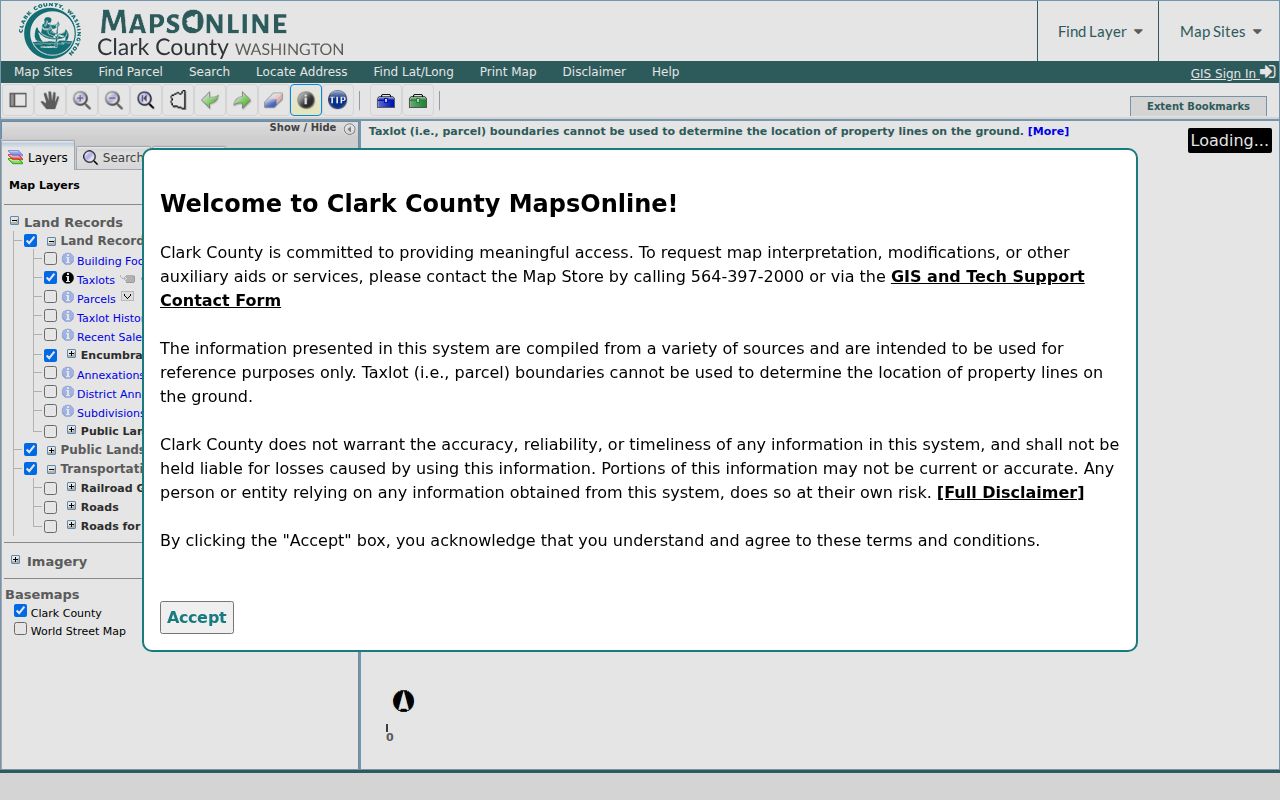
Its layers add civic and land context, but each owner fact should be checked on the linked property account.
Reading Hazel Dell Parcel Cards
PIC distinguishes the situs address, the place where the parcel sits, from the tax mailing address. Those fields may match, but they need not. An owner can be an individual, an estate, a trustee, or a company. One researched card for a multifamily parcel on NE Minnehaha Street lists an entity and an Oregon management mailing line. That supports title research, not a claim that an individual lives there.
- Parcel
- A mapped piece of land with its own county tax account.
- Situs address
- The physical address assigned to the property.
- Mailing address
- Where the county sends tax mail to the owner or manager.
- Legal description
- The recorded land wording used to keep the same property linked across deeds and address changes.
PIC also reports sale history, value, zoning, neighborhood, schools, parks, public safety, transit, utility, and permit links. These can help distinguish two lots with similar street numbers. They still do not identify all Hazel Dell neighbors who use the property.
Hazel Dell Neighborhood Contacts
Hazel Dell has two county-listed neighborhood associations with different histories and boundary descriptions. They are civic groups, not units of city government. Neither page offers a household roster. Their value is public contact, meeting, boundary, and local-event context.
Northeast Hazel Dell Association
Established in April 1996. Its boundary description uses 104th Street, 50th Avenue, St Johns Road, the Vancouver boundary, and I-5.
County association page
President: William Cline
Email: nehdna2021@gmail.com
West Hazel Dell Association
The group began in November 2002. Its page uses North 99th Street, NE Hazel Dell Avenue, NW 105th, I-5, and the Vancouver boundary.
County association page
Current status: Neighborhood Inactive
President: vacant
County Neighborhood Directory
The county map accepts an address and links to the matching neighborhood page. The property account’s Administrative Data may also name a neighborhood.
Association directory
Phone: 564.397.2316
Email: marilee.mccall@clark.wa.gov
The county directory does not maintain private HOA files or offer advice on covenants, conditions, and restrictions. Recorded covenants belong with Clark County Auditor Recording. A neighborhood association boundary also should not be treated as the Hazel Dell census line, a ZIP boundary, or Vancouver city limits.
The captured county neighborhood directory shows the official address-and-map route.
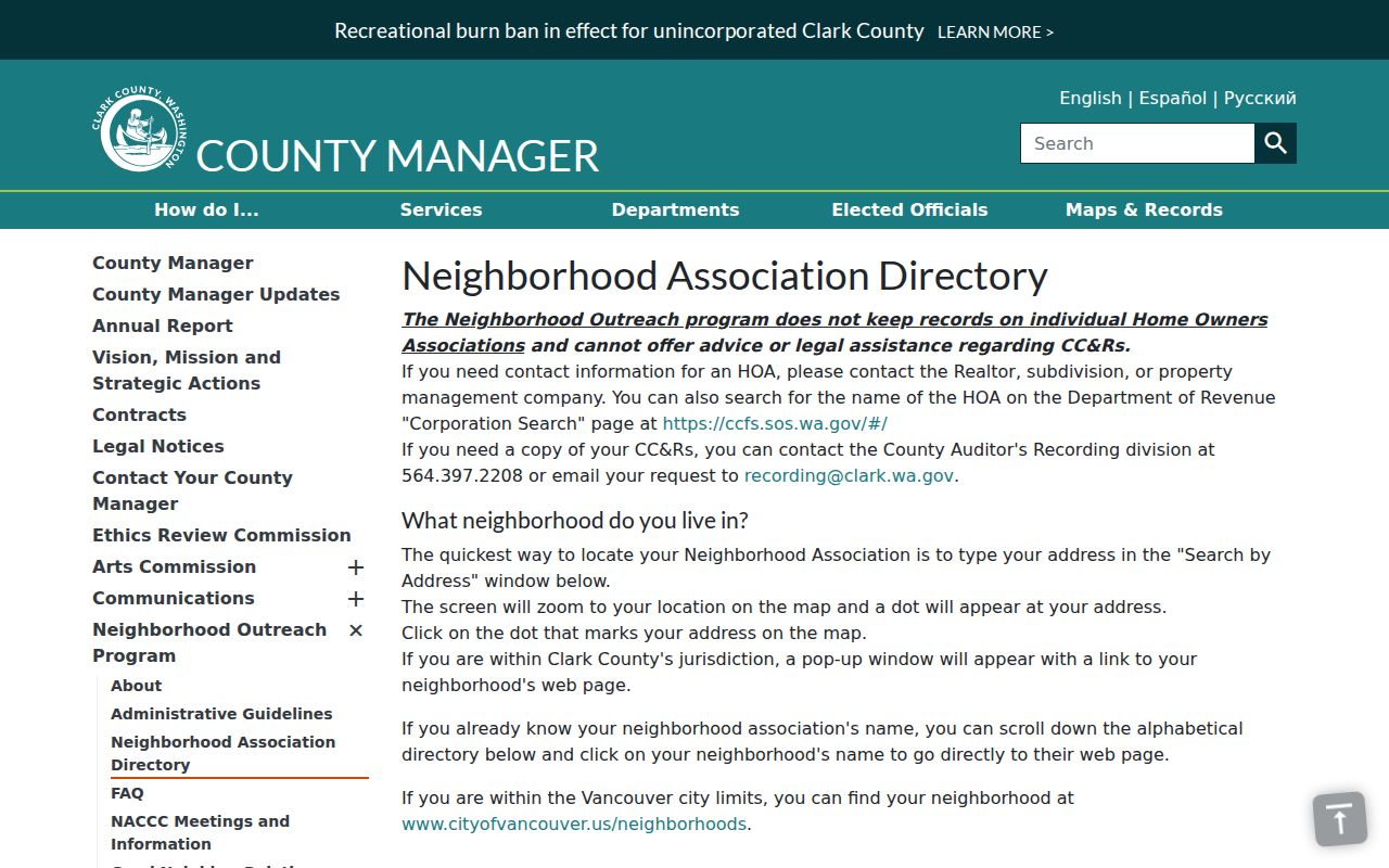
Use the popup link to reach a civic page, then read its current status before relying on meeting or officer details.
Which Hazel Dell Block Is It
Hazel Dell is a census-designated place, not an incorporated city. Clark County keeps the core property and land records. A parcel can show Vancouver as its postal city while remaining in unincorporated county jurisdiction. That is why the map must keep postal, census, association, and city boundaries separate.
The Northeast association area and West association area do not cover one identical geography. The Highway 99 planning area also reaches toward Felida, Lake Shore, Salmon Creek, and the fairgrounds. Local parcel examples use ZIP 98665, while nearby Hazel Dell-area records can show 98663, 98685, or 98686. ZIP alone cannot decide who your Hazel Dell neighbors are.
Public facilities can serve as map checks. Hazel Dell Community Park is at 2300 NE 68th St. Fire District 6 Station 61 is at 8800 NE Hazel Dell Ave. They provide civic context, not resident names. The Northeast association’s long-running Christmas event reportedly served more than 500 children for about 20 years, last noted in 2018, yet that figure is not an association membership count.
Hazel Dell Voter Block Limits
VoteWA is a self-lookup requiring first name, last name, date of birth, and CAPTCHA. It has no public street browse. The wider Washington voter database extract may contain residence, mailing, precinct, district, and participation fields, but it comes through a Secretary of State request and a statutory agreement. Washington bars commercial solicitation and harassment uses.
Full dates of birth, driver identification details, signatures, and Address Confidentiality Program addresses stay protected. A voter record is not a list of everyone at a home. Children, nonregistered adults, some protected people, and residents who have moved may not appear in the way a block search expects. Treat the record as registration data, not household proof.
Myth check. There is no public VoteWA map of every voter on a Hazel Dell block, and the county parcel layer is not a household roll.
Hazel Dell Neighbor Tool Comparison
Official records and commercial neighbor tools have different purposes. A compiled product may be quick, but its data can be old, merged, or detached from the source date. Clark County records are narrower and more work to combine, yet each field has an identifiable keeper.
| Source Type | Useful For | Core Limit |
|---|---|---|
| County parcel and GIS records | Lot, owner, account, districts, and map context | Owner is not the same as occupant |
| Civic association pages | Boundaries, public contacts, notices, and meetings | No member or resident roster |
| Lawful voter extract | Permitted registration and precinct research | Protected fields and strict use limits |
| Commercial compilations | Possible leads gathered from many feeds | Stale addresses and merged same-name people |
When a commercial result conflicts with PIC, MapsOnline, or a custodian’s current file, return to the original record. Note its date and field meaning. Do not infer a private family tie or shared home from an address association alone.
Past Hazel Dell Neighbors
Historic directories can show who was listed at nearby addresses in one publication year. Clark County Genealogical Society has Vancouver Polk directories for several years including 1959, 1972, 1976, 1978, and 1979, plus other county directory material. Reverse or criss-cross sections are arranged by street or phone rather than surname, making them useful for a past block.
Publication gaps remain. Earlier records may use “Clarke County,” and a Vancouver mailing label can hide the modern Hazel Dell place-name. Pair the directory with the census, an obituary, a deed, or a legal description. A dated listing proves only what that edition printed. The Hazel Dell city directories page covers the collections and their access points in depth.
Privacy for Hazel Dell Neighbors
Parcel maps do not disclose every renter, child, family member, guest, or non-owner adult. Utility customers, delivery data, DMV addresses, private HOA rolls, and protected victim addresses are not public block records. An absent name does not prove that a person is absent. It may reflect nonownership, a dated file, an index variation, or a confidentiality rule.
Washington’s Address Confidentiality Program gives qualifying survivors and other protected participants a substitute address and shields certain voter and marriage records. Court files can also be sealed or confidential. Respect those boundaries. If a public property field is wrong, contact the Assessor with the account number rather than spreading the error.
Lawful use. Use Hazel Dell neighbor records for civic awareness, personal safety, or respectful contact. Never use them to watch, harass, intimidate, or harm a person.