
Walk a Hazel Dell Street
A sound Hazel Dell street directory search starts with one known address, not a name alone. Clark County divides the evidence among separate systems. The property card identifies the parcel and recorded owner. MapsOnline shows how that parcel fits beside the road and adjoining lots. Landmark Web then links owners and entities to recorded deeds. Voter data and old reverse directories can add residence clues, but neither should be treated as a complete household roll.
- Enter the house number and street in the Clark County Property Information Center. Partial addresses are accepted. Save the tax account, situs address, legal description, owner, mailing line, and latest sale reference.
- Open MapsOnline, choose Find Parcel, select the matching result, and zoom until parcel lines are clear. Use Info or Identify on lots along the road.
- Follow the parcel or instrument clue into Landmark Web. Search by parcel, legal description, instrument, or party name to test the deed chain.
- For lawful research across a wider street, request the state voter extract and work within its restrictions. VoteWA itself checks only the registered person's own record.
- For an older occupant clue, consult the Clark County Genealogical Society, State Library, or FVRLibraries directory resources. A reverse or criss-cross directory is arranged by street address rather than only by surname.
This sequence keeps each claim tied to its source. Ownership is not the same as occupancy. A voter address is not proof that every person in a home appears there. The address chain is strongest when two independent records agree on the same parcel and time.
Search Hazel Dell Parcel Fields
The county's PIC is the working front door for a modern street search. Its public web route accepts an address or tax account. Searching by owner name is different: that option is available only on Joint Lobby self-service computers. The online screen may also require a robot check, which can remain valid for seven days after it is passed.
| Search control | Input | Requirement | How it works |
|---|---|---|---|
| Street address | Text | Needed for address route | House number and street; partial address is supported |
| Tax account | Text | Needed for account route | Opens the matching account and Fact Sheet |
| Possible matches | Result list | When several results exist | Select the correct address or account |
| Owner name | Name search | Not on public web route | Available at Joint Lobby self-service computers |
| Fact Sheet | Link | After selection | Shows the parcel summary and print options |
A parcel card can show owner and mailing names, tax and property status, area, values, sale facts, zoning, neighborhood, schools, utilities, and other districts. It does not list all people who live there. If PIC is unavailable, GIS support can be reached at 564-397-2002 extension 4652 or GISTechSupport@clark.wa.gov, while an owner-name inquiry requires the county lobby terminal.
Read Hazel Dell Address Terms
Three address fields often look alike but answer different questions. Record them separately before moving from a parcel card to a deed or permit. This is a useful Hazel Dell street directory habit because many local records use Vancouver as the postal city even when the parcel is in unincorporated Clark County.
- Parcel
- A mapped unit of land tied to a county tax account.
- Situs address
- The physical location assigned to the parcel, not the place where tax mail must go.
- Legal description
- The formal land description, such as subdivision, lot and block, section-township-range, or metes and bounds.
- Plat
- A recorded map that divides or defines lots, roads, and easements.
- Criss-cross directory
- A directory arranged by street and house number, letting a reader move from address to a listed name.
A same-as-situs mailing line supports, but does not prove, an occupancy link. A different mailing line may point to an owner, agent, or office elsewhere. The legal description is often the most stable bridge when a street spelling, number, or postal label changes.
Browse Hazel Dell Parcels
MapsOnline turns one parcel result into a manual street-by-street view. Choose Find Parcel, enter a parcel, house number, or partial street, and select a match. After the map zooms, use Identify on the target and the adjoining polygons. Repeat the action along the road, taking care not to confuse a road right-of-way with a privately owned lot.
The layer list adds context that a name list cannot supply: parcels, zoning, flood and elevation data, permits and site plans, neighborhoods, ZIP areas, schools, public safety, elections, utilities, and taxing districts. Each layer describes a different boundary. A school or water district on a parcel card does not identify who lives there.
The Clark County MapsOnline viewer shows the Find Parcel and layer controls used for this street walk.
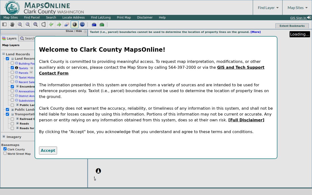
The screen is useful for map context and adjacent parcels, while owner and mailing details should still be checked in the linked PIC Fact Sheet.
Hazel Dell Records by Street
No single Clark County system supplies a complete street directory. The source matrix below keeps ownership, map context, recorded transfers, permits, voter data, and printed address evidence in their proper lanes. It also shows the fallback when the public portal does not answer the question.
| Address source | Custodian | Street evidence | Access route |
|---|---|---|---|
| Property card | Clark County Assessor | Owner, situs, mailing line, account, legal description, sale | PIC by address/account; owner name at lobby computers |
| Parcel map | Clark County GIS | Lot geometry, nearby parcels, districts and layers | MapsOnline; GIS support by phone or email |
| Recorded instruments | Clark County Auditor | Grantor/grantee, deed, lien, easement, plat, instrument date | Landmark index; counter or mail for copies |
| Permit records | Community Development | Case type, issue date, status, selected documents | PIC permit tab, LMS, map layers, or PRA request |
| Voter registration | Washington Secretary of State | Lawful extract may include address and precinct fields | VoteWA self-check or restricted VRDB request |
| Historical directories | Libraries and archives | Published name, address, business, and phone clues by year | CCGS, State Library, FVRL, museum, archives |
The account and legal description connect the strongest modern sources. Street spelling links the printed sources, but it is less stable. When a result is missing, use the verified fallback chain: online index, county terminal or counter, written copy or Public Records Act request, then archives, library, or historical society.
Trace Hazel Dell Street Deeds
Landmark Web is the county Auditor's free recorded-document index. Its tabs include Name, Document Type, Book and Page, Case Number, Instrument Number, Parcel ID, Record Date, Legal Search, Quick Search, and Marriage. In a name search, Party Type may be grantor, grantee, or both; Match Type may start with, contain, or equal the entered name.
Begin with the current PIC sale or instrument number. If that route fails, search the owner as grantee, then read the deed for the seller's exact legal name. Repeat with that seller as an earlier grantee. Keep checking the legal description because a street address alone may fail after a parcel split, boundary adjustment, short plat, or lot merger.
Landmark Web displays the recorded-document disclaimer and search tabs used to build this part of a Hazel Dell street directory.
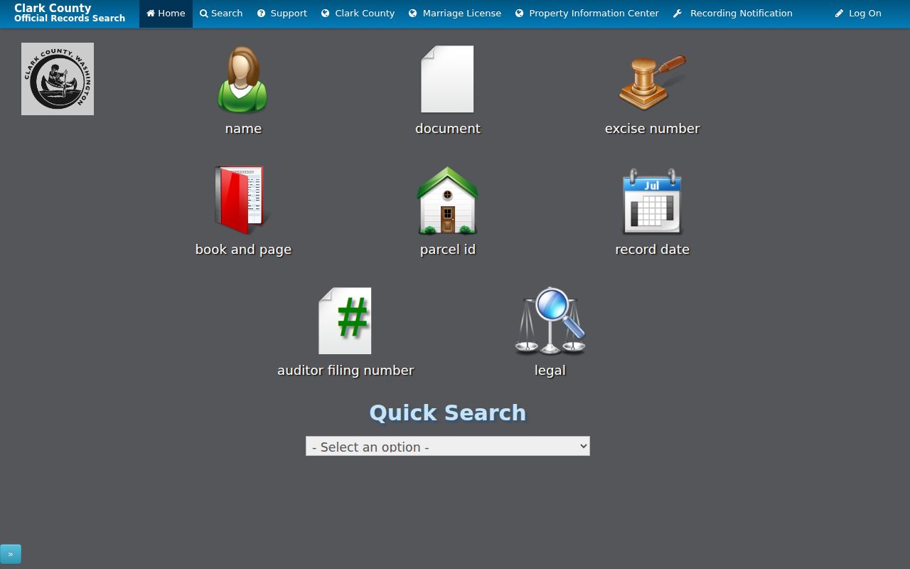
Online images are uncertified. For an official copy, use Auditor Recording at 1300 Franklin Street, second floor, Vancouver, or submit the county's certified-copy form by mail with payment and a return envelope.
Date Hazel Dell Address Changes
Permits can place a dated event at an address even when they do not name every occupant. The PIC permit tab may show a Tidemark or LMS case type, issued date, status, and sometimes a Docs icon. Search an LMS number at Clark County's permit portal. MapsOnline also offers Permits and Site Plans under Map Sites; zoom to the parcel, enable the permit layers, show the legend, and use Identify on a symbol.
Not all historical permit files are online. Weekly building-permit and proposed-development reports offer another date index. For older Tidemark detail or a public code record, send Community Development a focused Public Records Act request that identifies the address, date range, and known case number. Agencies generally must produce, link, acknowledge with an estimate, or deny within five business days under RCW 42.56.520.
Voter Clues Along Hazel Dell
VoteWA is not a public street browser. It asks a voter for first name, last name, date of birth, and a CAPTCHA to check that person's own registration, precinct, and ballot status. A wider voter-registration database extract is requested from the Washington Secretary of State, not casually searched one block at a time.
The requested file can contain public name, residential and mailing address, precinct and district codes, registration date, and participation indicators. Full birth dates, identification numbers, signatures, and protected voter addresses are withheld. Washington also prohibits commercial solicitation from voter lists and requires reasonable safeguards. Use voter evidence only as a dated registration clue, never as proof of a full household or how anyone voted.
Extend the Hazel Dell Directory
Printed street and telephone directories cover the era before current portals. Local runs are patchy, not annual. CCGS and the Washington State Library identify editions including 1907-08, 1918-19, 1921, 1928-29, 1931, 1934, 1936, 1938, 1940, 1950, 1955, 1958, 1959, 1972, 1976, 1978, and 1979, plus a June 1951 telephone directory. Check the catalog for the specific year rather than assuming every volume survives.
Use the street section or criss-cross order to move from an old address to a listed householder, business, or phone. Then confirm the name in the alphabetical section, a census, deed, newspaper, or obituary. The Hazel Dell city directories page covers those collections in depth. Because Hazel Dell is unincorporated, older entries may carry Vancouver or the earlier local place-name Anderson.
Separate Hazel Dell Boundaries
A Vancouver mailing address does not establish Vancouver city jurisdiction. Hazel Dell is a census-designated place in Clark County, and its postal, census, association, planning, and municipal borders do not perfectly match. Check the MapsOnline city-boundary and neighborhood layers before sending a request to a city office.
Northeast Hazel Dell and West Hazel Dell also have distinct association boundaries. Those county pages publish boundary and civic contacts, not household rosters. If a parcel falls inside Vancouver, city permit or cemetery sources may become relevant. If it remains in unincorporated Hazel Dell, county offices are the main custodians.
Insider tip. Record both situs and mailing lines before following a deed; they can point to different places and different people.
Limits of Hazel Dell Street Records
Address-keyed public records do not reveal a complete current household. They may miss renters, relatives, guests, people who moved recently, and anyone not tied to the indexed event. Utility customer and delivery records are not public resident rolls. Federal law restricts personal motor-vehicle address data. Washington's Address Confidentiality Program protects qualifying participants through a substitute address and special voter procedures.
The county map is also a tax-purpose best fit, not a survey. A Q flag on a property card can signal a defective legal description or a gap between grantors and the current owner. It is a prompt to obtain more deeds or cadastral help, not a label about any person. No official Hazel Dell street-renumbering year was found, so bridge an old address with parcel geometry, plats, legal descriptions, directory spellings, and recorded deeds instead of guessing.
Lawful use. Use Hazel Dell address records for legitimate personal research, and never to stalk, harass, threaten, or intimidate anyone.